


LAKE MICHIGAN, Lake County, Illinois
About
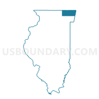
Outline

Summary
| Unique Area Identifier | 572408 |
| Name | LAKE MICHIGAN |
| County | Lake County |
| State | Illinois |
| Area (square miles) | 897.83 |
| Land Area (square miles) | 0.00 |
| Water Area (square miles) | 897.83 |
| % of Land Area | 0.00 |
| % of Water Area | 100.00 |
| Latitude of the Internal Point | 42.32644350 |
| Longtitude of the Internal Point | -87.43611780 |
Maps


Graphs
Select a template below for downloading or customizing gragh for LAKE MICHIGAN, Lake County, Illinois


Neighbors
Neighoring Voting District (by Name) Neighboring Voting District on the Map
- BENTON 51 Voting District, Lake County, IL
- BENTON 55 Voting District, Lake County, IL
- BENTON 56 Voting District, Lake County, IL
- BENTON 61 Voting District, Lake County, IL
- BRIGHTON -T 9999 Voting District, Kenosha County, WI
- Lake Michigan Voting District, Cook County, IL
- MORAINE 201 Voting District, Lake County, IL
- MORAINE 202 Voting District, Lake County, IL
- MORAINE 207 Voting District, Lake County, IL
- MORAINE 208 Voting District, Lake County, IL
- MORAINE 215 Voting District, Lake County, IL
- MORAINE 216 Voting District, Lake County, IL
- MORAINE 217 Voting District, Lake County, IL
- MORAINE 228 Voting District, Lake County, IL
- MORAINE 229 Voting District, Lake County, IL
- New Trier 1 Voting District, Cook County, IL
- Pleasant Prairie - V 5 Voting District, Kenosha County, WI
- SHIELDS 239 Voting District, Lake County, IL
- SHIELDS 240 Voting District, Lake County, IL
- SHIELDS 245 Voting District, Lake County, IL
- SHIELDS 251 Voting District, Lake County, IL
- SHIELDS 252 Voting District, Lake County, IL
- SHIELDS 253 Voting District, Lake County, IL
- SHIELDS 254 Voting District, Lake County, IL
- WAUKEGAN 360 Voting District, Lake County, IL
- WAUKEGAN 376 Voting District, Lake County, IL
- WAUKEGAN 379 Voting District, Lake County, IL
- WAUKEGAN 392 Voting District, Lake County, IL
- WAUKEGAN 399 Voting District, Lake County, IL
- ZION 431 Voting District, Lake County, IL
- ZION 432 Voting District, Lake County, IL
- Voting Districts not defined, Allegan County, MI
- Voting Districts not defined, Berrien County, MI
- Voting Districts not defined, Van Buren County, MI
Top 10 Neighboring County Subdivision (by Population) Neighboring County Subdivision on the Map
- Waukegan township, Lake County, IL (90,893)
- New Trier township, Cook County, IL (55,424)
- Shields township, Lake County, IL (39,062)
- Moraine township, Lake County, IL (34,129)
- Zion township, Lake County, IL (24,413)
- Pleasant Prairie village, Kenosha County, WI (19,719)
- Benton township, Lake County, IL (18,951)
- County subdivisions not defined, Cook County, IL (0)
- County subdivisions not defined, Lake County, IL (0)
- County subdivisions not defined, Van Buren County, MI (0)
Top 10 Neighboring Place (by Population) Neighboring Place on the Map
- Waukegan city, IL (89,078)
- North Chicago city, IL (32,574)
- Highland Park city, IL (29,763)
- Zion city, IL (24,413)
- Pleasant Prairie village, WI (19,719)
- Lake Forest city, IL (19,375)
- Glencoe village, IL (8,723)
- Winthrop Harbor village, IL (6,742)
- Lake Bluff village, IL (5,722)
Top 10 Neighboring Elementary School District (by Population) Neighboring Elementary School District on the Map
- North Shore School District 112, IL (35,413)
- Beach Park Community Consolidated School District 3, IL (20,315)
- Lake Forest School District 67, IL (19,064)
- Zion Elementary School District 6, IL (17,472)
- Lake Bluff Elementary School District 65, IL (8,876)
- Glencoe School District 35, IL (8,528)
- Winthrop Harbor School District 1, IL (6,628)
Top 10 Neighboring Secondary School District (by Population) Neighboring Secondary School District on the Map
- New Trier Township High School District 203, IL (59,796)
- Township High School District 113, IL (58,323)
- Zion-Benton Township High School District 126, IL (44,411)
- Lake Forest Community High School District 115, IL (28,251)
Top 10 Neighboring Unified School District (by Population) Neighboring Unified School District on the Map
- Kenosha School District, WI (127,931)
- Waukegan Community Unit School District 60, IL (84,015)
- North Chicago School District 187, IL (30,274)
- School District Not Defined (Water), MI (243)
- School District Not Defined (Water), IL (0)
- School District Not Defined (Water), WI (0)
Top 10 Neighboring State Legislative District Lower Chamber (by Population) Neighboring State Legislative District Lower Chamber on the Map
- State House District 61, IL (120,629)
- State House District 60, IL (101,630)
- State House District 58, IL (101,562)
- State House District 80, MI (87,871)
- State House District 78, MI (86,900)
- Assembly District 65, WI (61,608)
- Assembly District 64, WI (56,844)
- State House Districts not defined, IL (0)
Top 10 Neighboring State Legislative District Upper Chamber (by Population) Neighboring State Legislative District Upper Chamber on the Map
- State Senate District 24, MI (278,340)
- State Senate District 21, MI (266,141)
- State Senate District 31, IL (237,963)
- State Senate District 30, IL (213,957)
- State Senate District 29, IL (206,404)
- State Senate District 22, WI (180,019)
- State Senate Districts not defined, IL (0)
Top 10 Neighboring 111th Congressional District (by Population) Neighboring 111th Congressional District on the Map
- Congressional District 8, IL (738,840)
- Congressional District 1, WI (728,042)
- Congressional District 6, MI (671,883)
- Congressional District 10, IL (650,425)
Top 10 Neighboring Census Tract (by Population) Neighboring Census Tract on the Map
- Census Tract 8630.03, Lake County, IL (7,829)
- Census Tract 8606, Lake County, IL (6,977)
- Census Tract 20, Kenosha County, WI (5,870)
- Census Tract 8634, Lake County, IL (4,257)
- Census Tract 8622, Lake County, IL (4,103)
- Census Tract 8629.01, Lake County, IL (3,766)
- Census Tract 8656, Lake County, IL (3,525)
- Census Tract 8602, Lake County, IL (3,467)
- Census Tract 8601.04, Lake County, IL (3,419)
- Census Tract 8623, Lake County, IL (3,033)
Top 10 Neighboring 5-Digit ZIP Code Tabulation Area (by Population) Neighboring 5-Digit ZIP Code Tabulation Area on the Map
- 60085, IL (71,714)
- 60099, IL (31,104)
- 60035, IL (29,763)
- 60087, IL (26,978)
- 60045, IL (20,925)
- 53158, WI (15,917)
- 60088, IL (15,761)
- 60064, IL (15,407)
- 60044, IL (9,792)
- 60022, IL (8,153)